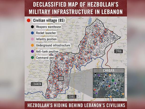
 IDF posted a map on Twitter Tuesday evening showing more than 200 locations south of the Litani River where Hezbollah has embedded weapons warehouses, weapons manufacturing facilities, rocket launch pads, and the like inside residential areas in towns and villages.
In the event of another war with Hezbollah, the IDF claimed it could potentially target those sites.
U.N. Resolution 1701 prohibited Hezbollah from embedding its military infrastructure south of the Litany river .
The map, according to Israel’s Channel 2, features “over 200 towns and villages” and shows over “10,000 potential targets for Israeli strikes” in the event of a new war between Israel and Hezbollah.
Israeli Prime Minister Benjamin Netanyahu admitted in April for the first time that Israel had carried out “dozens” of strikes on attempted arms transfers for Hezbollah inside Syria, promising it would continue to target the smuggling of “game changing” weaponry.
Israel’s defense minister said his country is working to prevent weapons of mass destruction from reaching Hezbollah. He made the statement hours after a rocket attack on a Damascus air base on Wednesday was blamed on Israel.

Leave a Reply
You must be logged in to post a comment.